
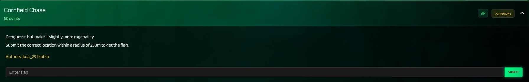
Despite the time limit i had i did several challenges in this ctf and i will walk you through the intresting osint challenge,hope you enjoy and read to the end,or just skeem but leave a reaction at the end it helps me alot in creating the content.Lets get into it…
Challenge.
On this challenge this is how i did it ,first of all we were given the link to the 360 image to locate the osint image.,…
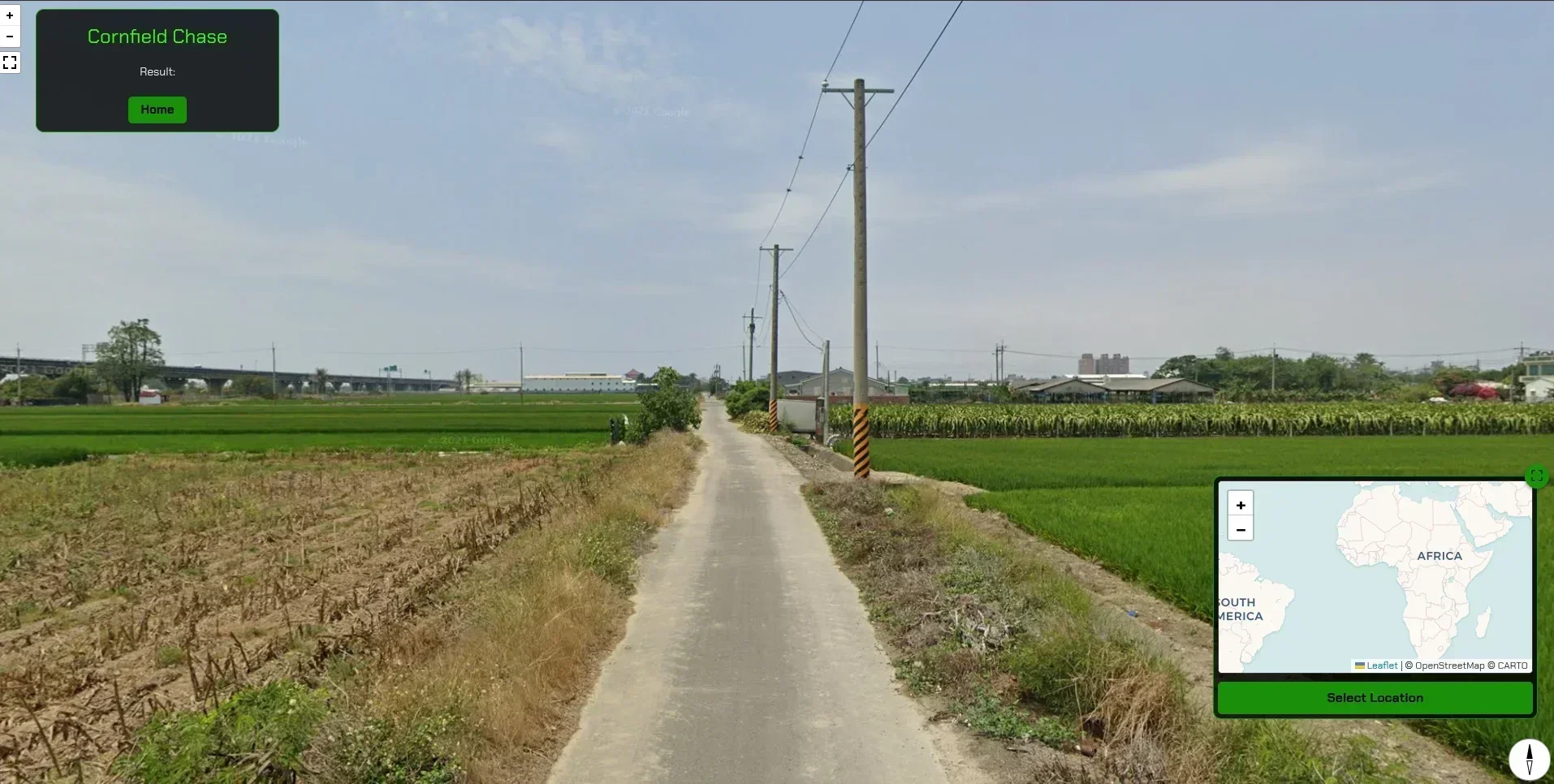
and there we were we got it the image ,
so lets put our detective skills to the test.
As usual i did a screenshot of the image and did a reverse image search but got nothing.
Sometimes, in OSINT (Open Source Intelligence) challenges, the smallest detail can blow a case wide open.
In this CTF challenge , the entire investigation began in a strange spot: a corn/rice field if it suits what you see. I couldn’t move — just look around. And then I saw it: a single electric pole with a small metal plaque.
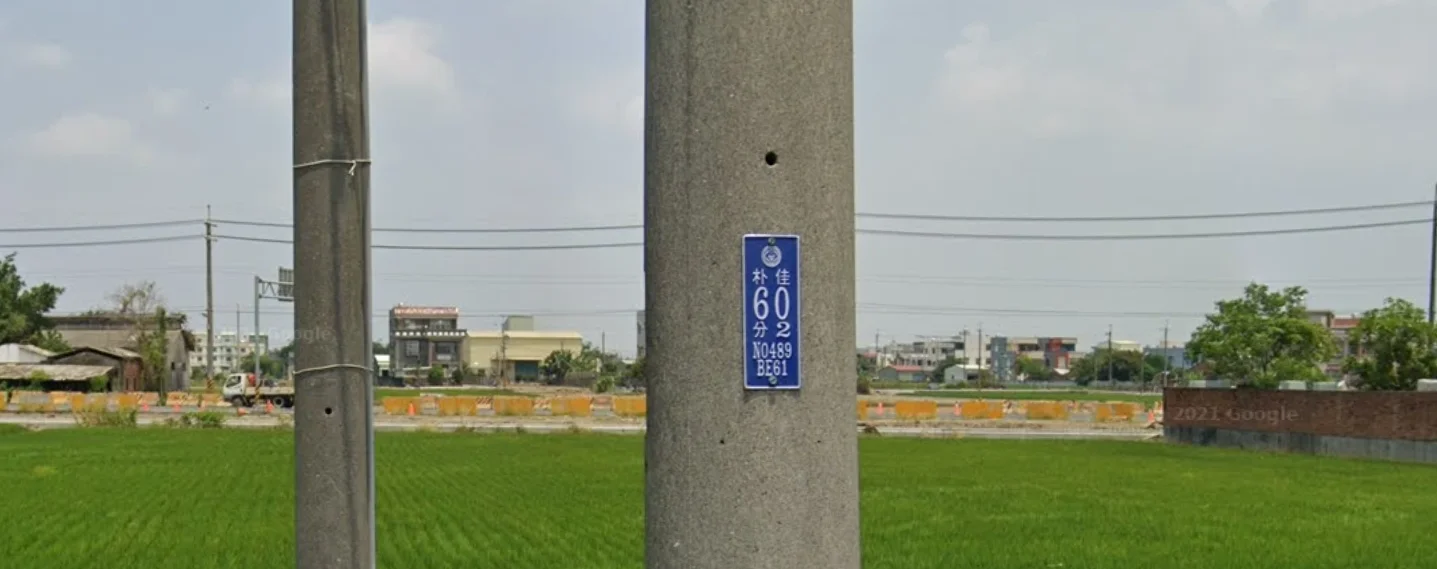
Step 1 — Recognizing the System
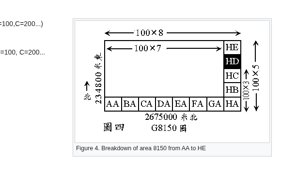
The plaque belonged to a Taiwanese electric pole. Taiwan Power Company has a grid algorithm — a systematic way to label every utility pole in the country so that workers can locate them quickly, even with nothing but pen and paper.
The whole algorithm you can read it here https://wiki.osgeo.org/wiki/Taiwan_Power_Company_grid
According to my pole number thats **N0489** this is what in short it means
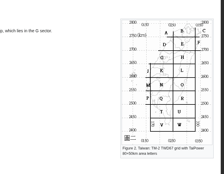
N refers to the large 80×50 km block labeled “N”
It sits below M, left of O, **above Q ,**So the first thing N0489 tells you is
Inside block N the the area is subdivided into 1 km × 1 km squares and numbered sequentially.
Taipower numbering convention:
First two digits (04) → east–west index.
Last two digits (89) → north–south index
so:
N 04 89
│ │ └─ northing index
│ └──── easting index
└────── main grid block
This gives you a specific 1 km square inside block N.
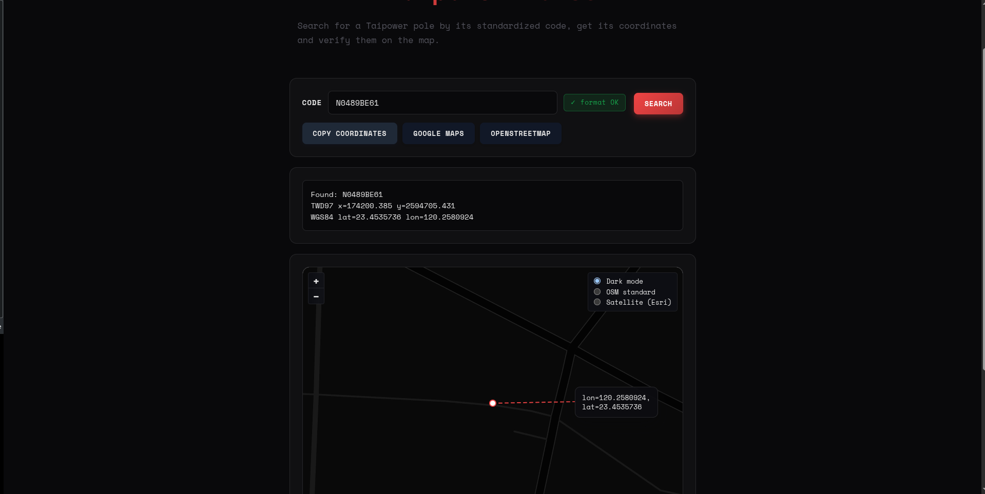
Step 2 — Narrowing It Down With a Second Code
And my code from the pole here its BE61 And for this we use the same system but diffrent grid thats this
for this grid it divides the area into:
- Horizontal (A–H)
- Vertical (A–E)
Here, B (horizontal) and E (vertical) narrowed the location even further. The number 61 could allow for even finer precision.
And then this whole math we did and there is automatic tool to automate that all work and just pinpoint the location so lets do that because we have learned something from that whole math and numbers
Step 3 - Automating the rest
found this tool online big up to the creator .https://0d.lv/toolbox/taipower
Just entered the full code from the Taiwanese utility pole we have— that is K2812CB64—and it instantly pinpointed the exact pole on a map.,that was very cool and easy.
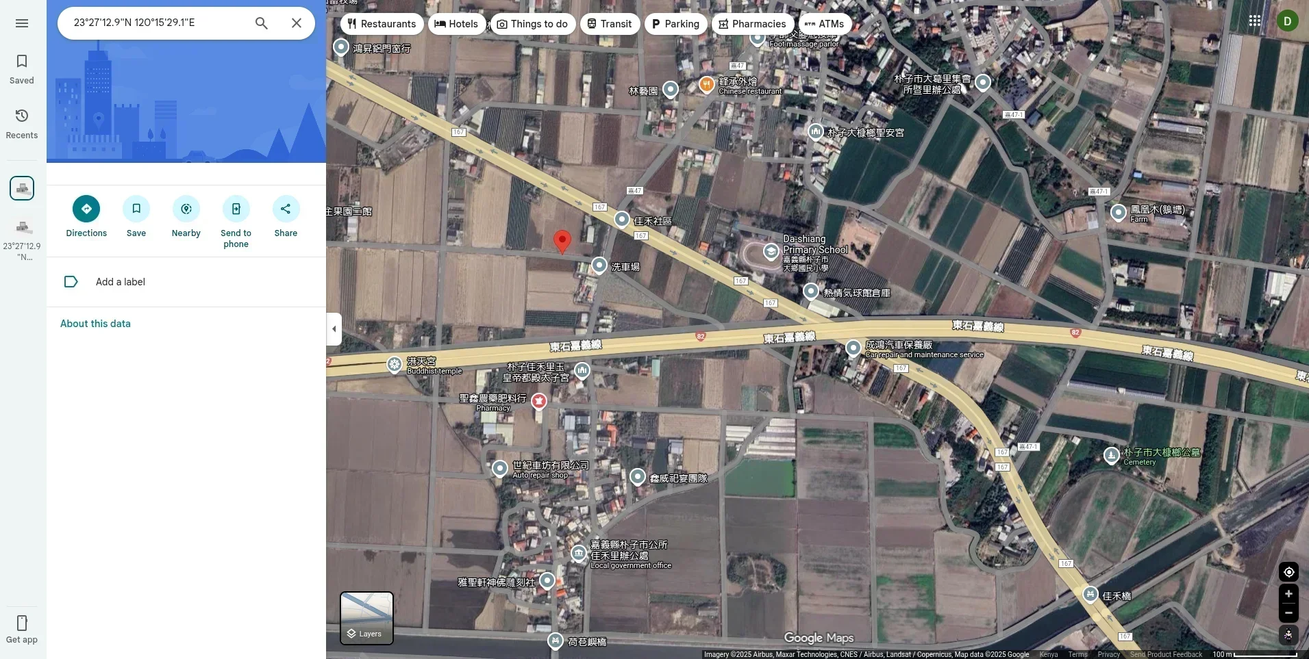
used google maps and i got a visuall
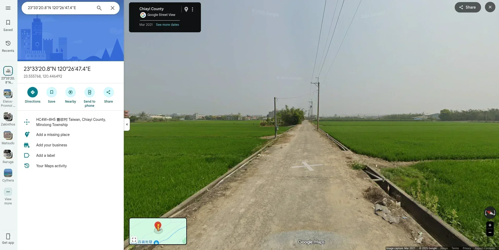
and for the street view its our exact location
and there we had it so …on entering the location thats pinpointing the location on our given map
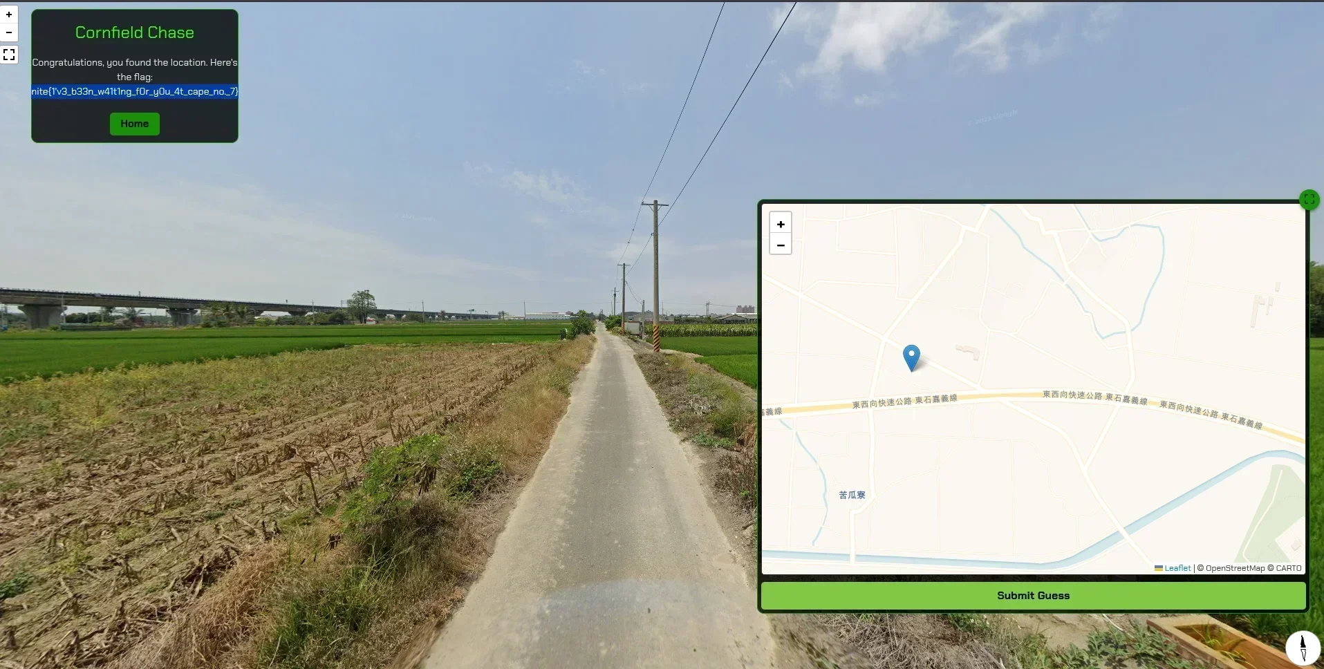
we got the flag.
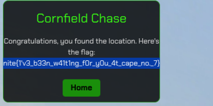
and there it was a single pole a banner/plaque and we got the needed location exactly,
Thats teaches you to pay attention even to the small details they matter in opensource inteligence
HAPPY OSINT!!!
PEACE ✌️


Comments